Offroad
Past pavement. Past cell service. Still on the map.
The map for trucks, jeeps, UTVs, and ATVs — on CarPlay, on the official Forest Service MVUM trails, and offline when the signal dies.
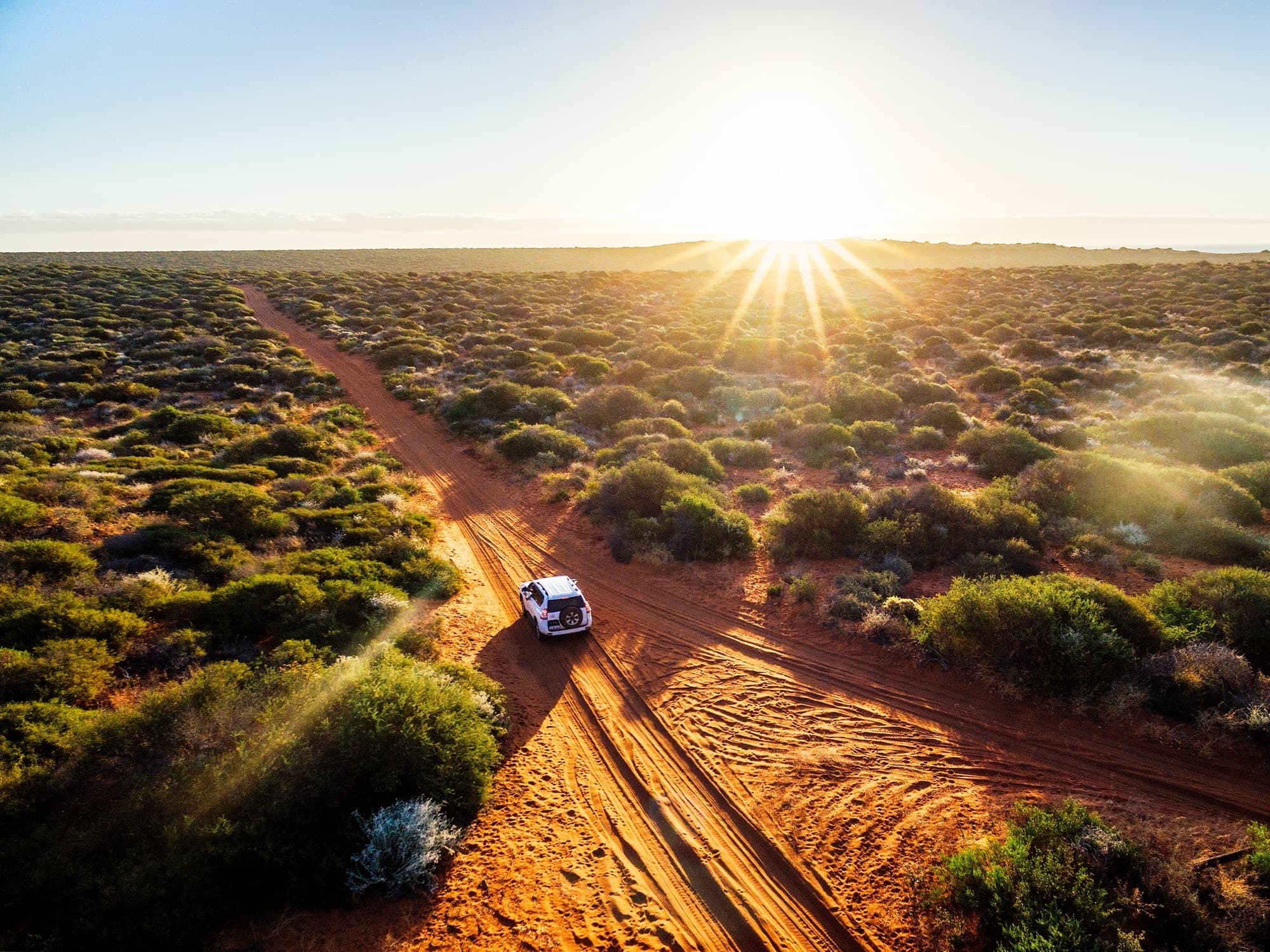
Past the last gas station
Built for where the pavement ends.
Most navigation apps stop somewhere around the last gas station. Topo Maps+ keeps going — our Glacier Topo maps show the official US Forest Service Motor Vehicle Use Map (MVUM) routes, plus the trail networks past them. And because it runs on CarPlay, your real map is on the screen in your truck all the way from the highway to the last passable mile.

The offroad arc
From the highway to the trail. And back.
Same map, the whole trip — planning at home, driving in CarPlay, and recording the route to come back to.
Plan it
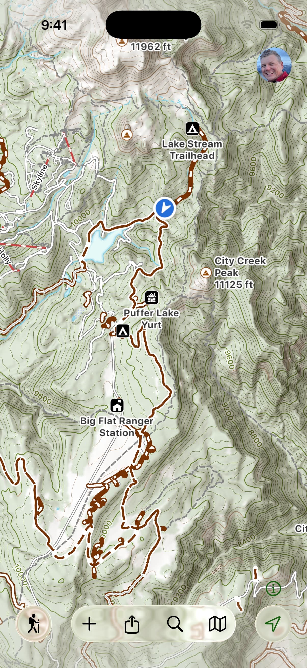
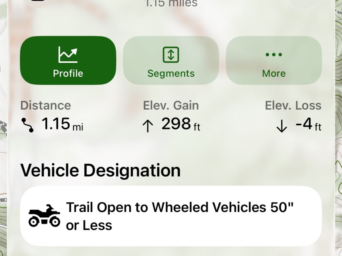
Pick the Offroad activity style for our Glacier Topo maps, which show the official US Forest Service MVUM routes — the official data for which forest roads and trails are open to which vehicle types, in which seasons. Layer in US public and private land (Elite) to know where you can and can’t be. Sketch the route on the Mac, iPad, or in the browser; check the elevation profile to see if your rig will make the climbs. Pre-download every map style and overlay so the whole trip works offline before you leave service.
Drive it
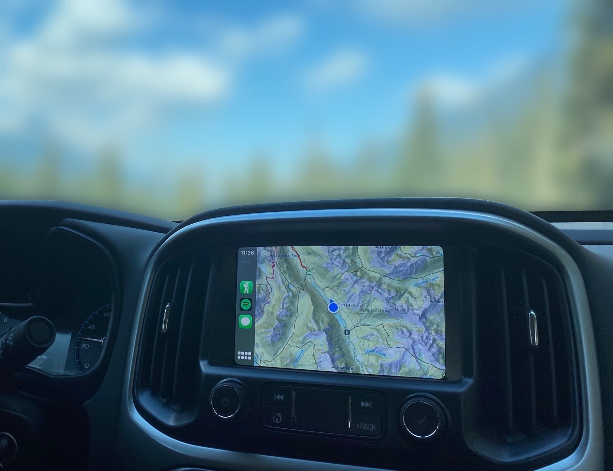
Topo Maps+ runs on your truck’s CarPlay display — your real map and your route right there on the dashboard. Especially useful for the last 30 miles of forest road where Google Maps gives up, and built for the moment the pavement ends. When the cell signal dies, the offline maps keep going.
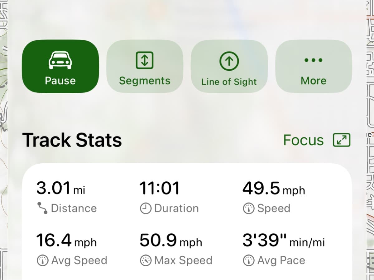
Bring it back
Tracking records the trail as you go — every mile, every climb, every detour. Print a paper map of the area with your routes and waypoints, magnetic declination, and a coordinate grid for backup or for the next trip. Share the GPX of the trip with your group, or sync it to your phone, watch, and the Mac you planned it on.
MVUM data, trail conditions, and access can change. Always verify with the managing agency before you go.
From the dirt
Past pavement, on the map.
“I recently did a 10-day off-road camping trip to the North Eastern Sierras where I took my jeep into the backcountry where I knew I would not have a signal of any kind. I preloaded the topographic maps into my cell phone and was amazed at how precise this mapping tool is.”
“I hike, off road, and ATV — having everything in one app = priceless.”
“Awesome for 4x4 when cell service is nil.”
Partner maps
Premium off-road maps from CartoTracks.
Link your CartoTracks account and your event and off-road park maps — King of the Hammers, private ranches, and more — appear right inside Topo Maps+, on every device.
Connect your CartoTracks maps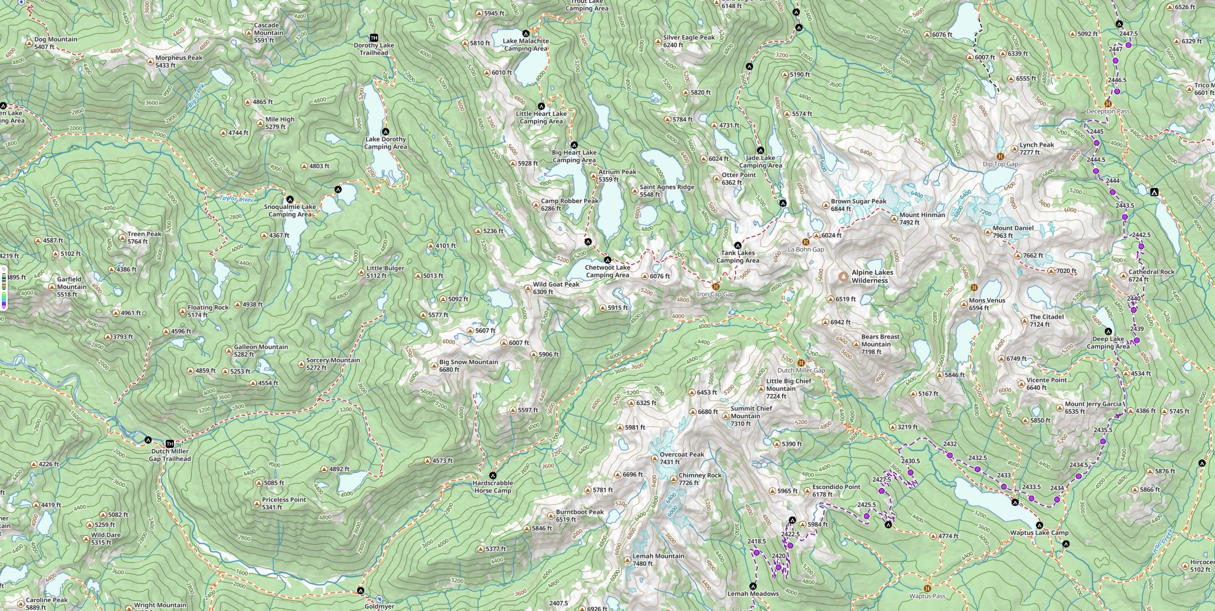
Get dirty
Plan the route. Drive it. Find your way back.
Free to try in your browser. The 7-day free trial unlocks the Glacier Topo maps with their MVUM routes, offline downloads, and the rest of the offroad toolkit.