
Line of Sight
This feature isn’t available in the Android app yet.
Line of Sight helps you figure out what you're actually looking at on the trail. Say you can see a peak but can't tell which one it is on the map: Line of Sight draws a line in the direction you're facing, with distances, and highlights in red what is visible to you.

Because it shows elevation along the line, it also reveals dips in the land between you and what you're looking at that you can't see from where you stand.
How to use Line of Sight
-
Tap your location, or tap and hold on the map. Then tap More.
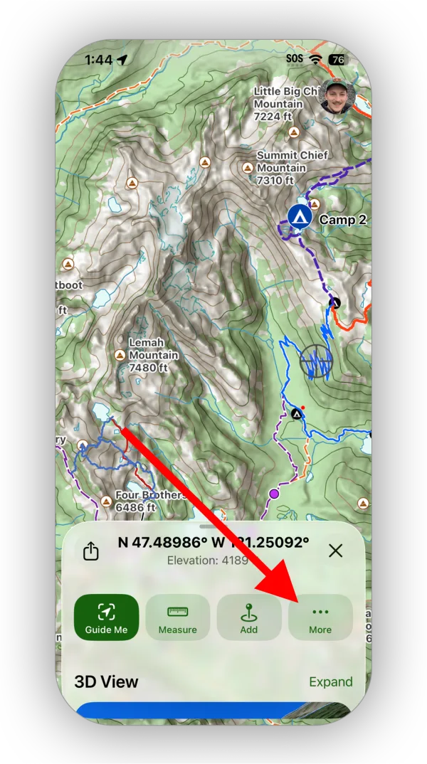
Shown on iPhone — Android looks slightly different. -
Tap Line of Sight.
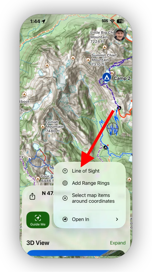
Shown on iPhone — Android looks slightly different. -
Point the top of your phone in the direction you're looking and adjust the distance as needed. Then tap Profile & Line of Sight Analysis.
If you started from a tap and hold, the line isn't tied to your location, so tap the map where you want it to point.
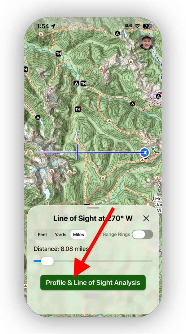
Shown on iPhone — Android looks slightly different. -
You'll see an elevation profile of the line. The areas you can actually see are highlighted in red.
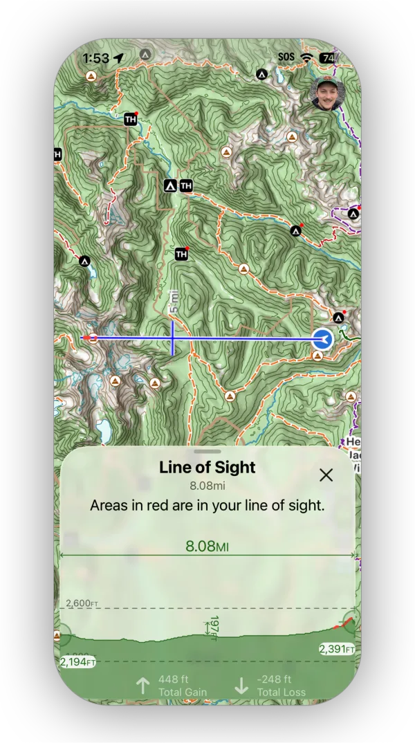
Shown on iPhone — Android looks slightly different.
Updated October 7, 2026
More in Planning Tools
Still need help?
We’re a small team and we read every message. Email support@topomaps.co and tell us which device you’re on.