
Printing & Exporting Maps
Using the web app? Printing Maps on the Web App
Topo Maps+ prints a customized map, or exports it as a PDF, right from the app. A paper map is a smart backup in case your phone's battery runs out. For a map that lasts the trip, print it on waterproof map paper or keep it in a waterproof case.
How to print or export a map
-
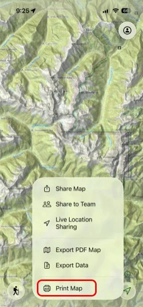
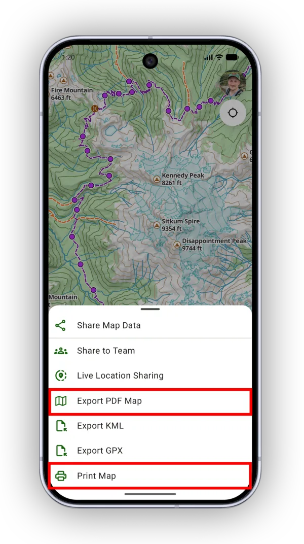
Tap the Share button in the toolbar.
-
Tap Print Map to print, or Export PDF Map to save or send the map as a PDF.
-
Set the area to print:
- For a single page, move and zoom the map until the print boundary shows the area you want.
- For a larger area, break it into chunks and tap Add Page for each one.
-
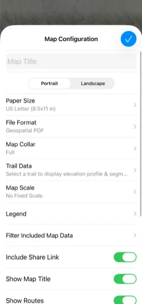
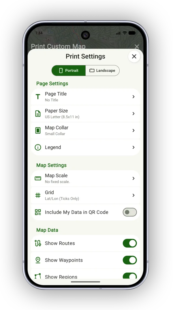
Tap Configure to change the page setup (see Page settings below). When you print multiple pages, each page keeps its own settings.
-
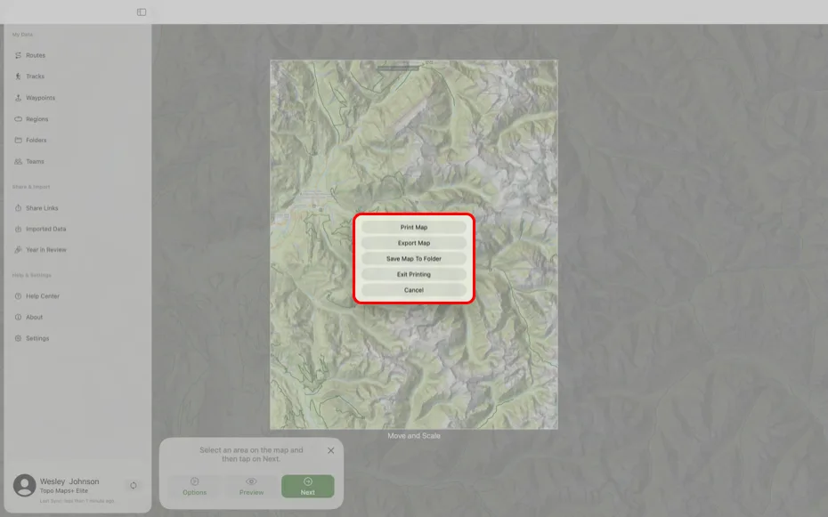
Tap Next, then tap Print Map, Export Map, or Save Map To Folder. Export Map lets you share the PDF or save it to Files without printing it. Save Map To Folder keeps the PDF in a folder with your trip data.
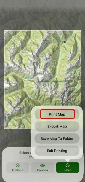
Shown on iPhone — Android looks slightly different. -
Tap the button at the bottom of the screen, such as Print 1 page, or Export 1 page when exporting a PDF.
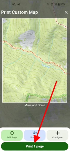
Shown on Android — iPhone looks slightly different.
Page settings
- Page Orientation: Portrait or Landscape.
- Page Title: An optional title shown at the top or bottom of the page, unless you choose No Collar.
- Paper Size: The paper size in your printer, so the dimensions line up correctly.
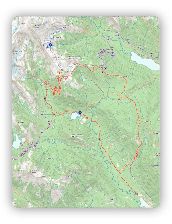
- Map Collar: No Collar, Small, or Full — three layouts with different spacing around the map. With no collar, the map fills the entire page. A small collar adds moderate spacing for the map scale, declination, and title. A full collar puts a larger border around the map. See the examples below.
- Legend: Add, edit, or leave out a legend for your data on the map.
- Map Scale: A fixed map scale (for example, 1 inch = 1 mile), or no fixed scale to print at the current map zoom.
- Grid: No Grid, Lat/Lon, Lat/Lon ticks, or UTM.
- Include My Data in QR Code: Every printed map has a QR code that opens the same map area in Topo Maps+. By default it doesn't include your data. Turn this on so people who scan the code also see your routes, waypoints, and regions.
- Map Data: Show or hide specific data types and their titles.
Example printed maps
Full collar:
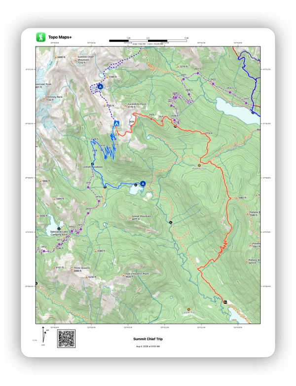
Small collar:
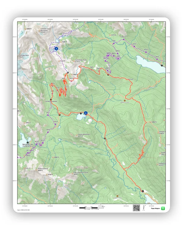
No collar:
On Mac
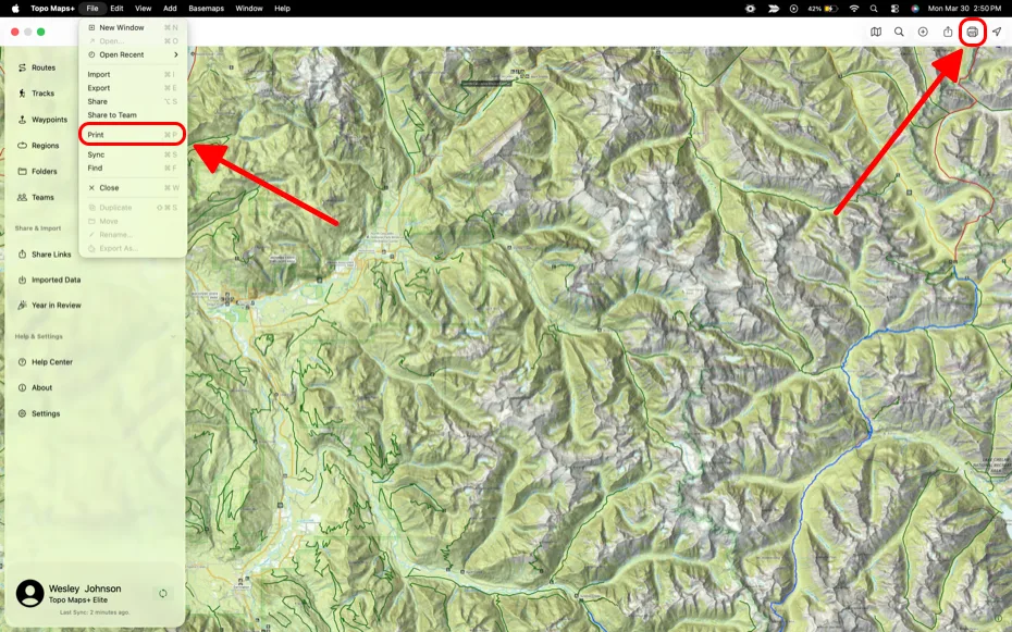
In the Mac app, sharing, exporting, and printing are in the File menu in the menu bar.
- Share or export: Choose Share or Export from the File menu, then select the data. When sharing, you also choose an image to show as the link's thumbnail.
- Print: Choose Print from the File menu, or click the Print icon in the top-right corner of the window. Then:
- Click Options to choose what shows on the map, the file type, and the orientation.
- Click Preview to generate a print preview. It downloads automatically, so you can view it offline.
- Click Next to print, export, or save the map to a folder.
Updated October 7, 2026
More in Import, Export & Share
Still need help?
We’re a small team and we read every message. Email support@topomaps.co and tell us which device you’re on.