
Importing GeoPDFs
Using the web app? Importing GeoPDFs on the Web App
Topo Maps+ imports geo-referenced PDF maps (GeoPDFs) as map overlays, so you can view an outside map right on top of your Topo Maps+ map. The file must be geo-referenced.
First, get the file onto your phone: email it to yourself, download it from the website that hosts it, or save it to iCloud Drive or the Files appyour device or Google Drive.
How to import a GeoPDF
-
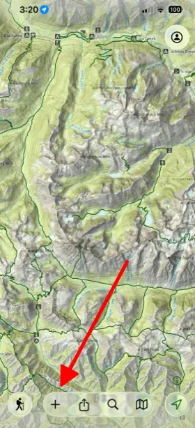
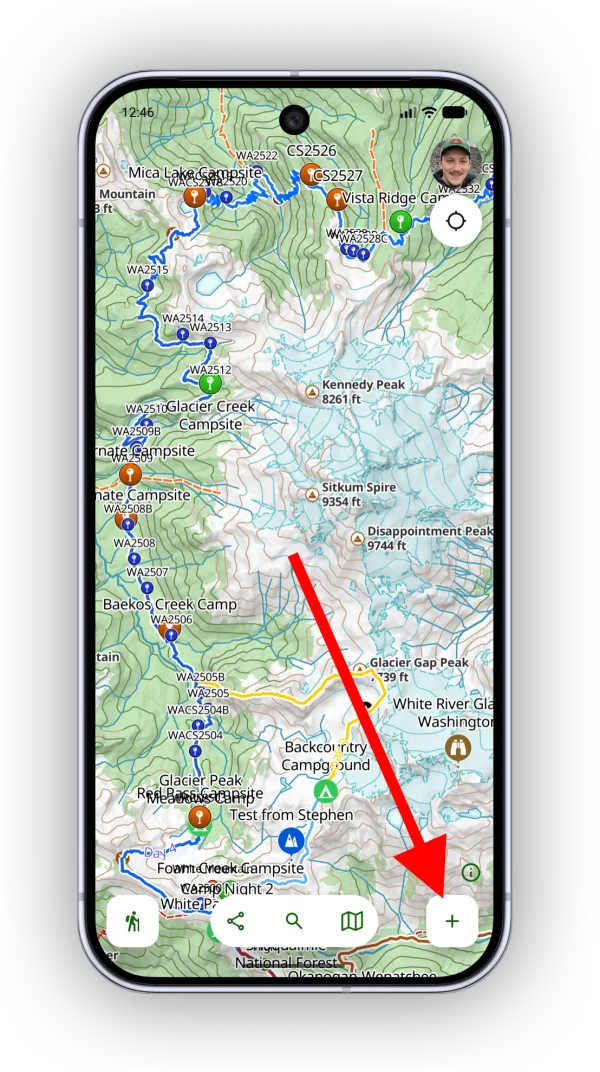
Tap the Add button in the toolbar.
-
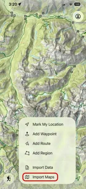
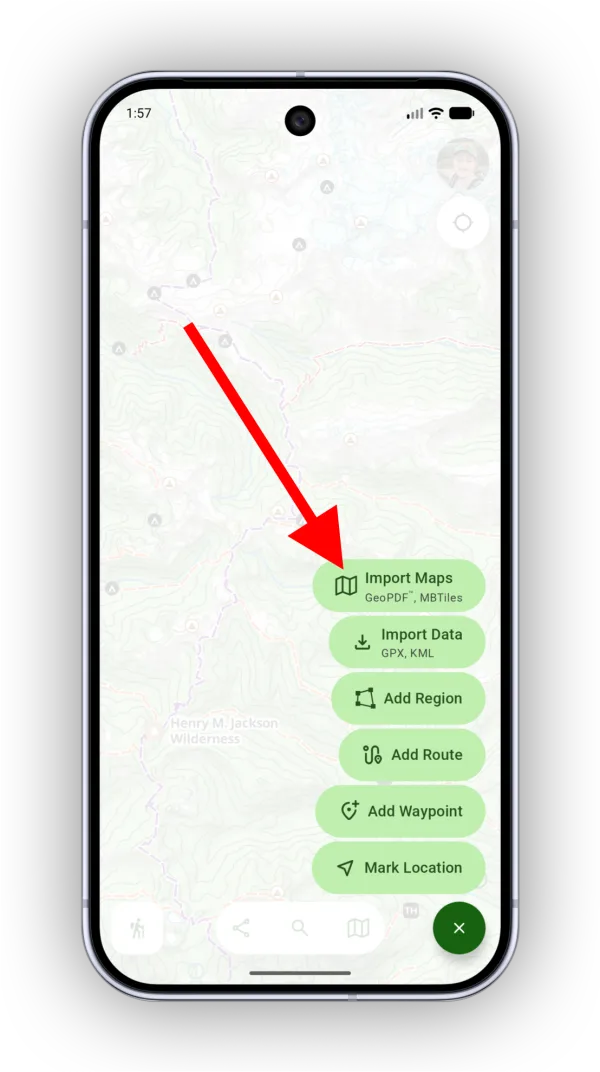
Tap Import Maps.
-
Select your file, then follow the import steps. Topo Maps+ walks you through them, showing a preview and the map's location so you can check it's the right file.
-
Choose the resolution to import. We recommend the highest resolution for the best results. Then tap Import Map.
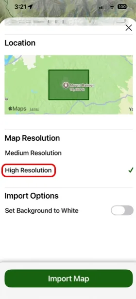
Shown on iPhone — Android looks slightly different.
How to view and adjust an imported map
-
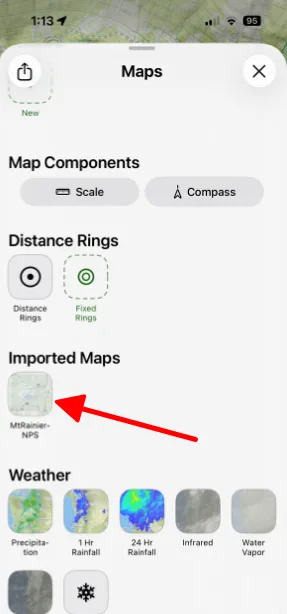
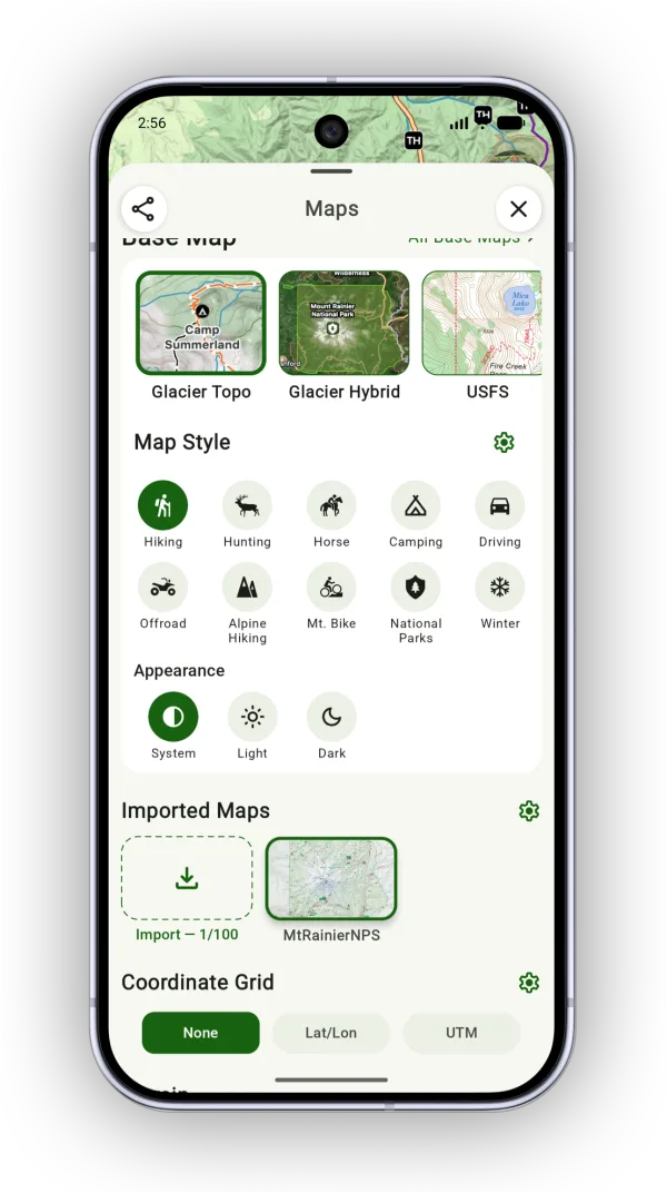
Tap the Maps button in the toolbar. Your map appears under Imported Maps. Tap it to turn it on or off.
-
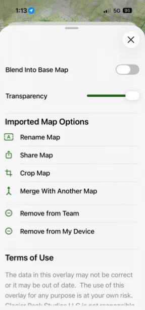
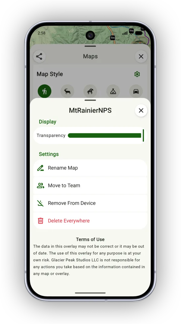
Tap and hold the map to see its settings, such as transparency, renaming, and moving it to a team.
-
Tap Manage to change which imported maps show in the panel.
Updated October 7, 2026
More in Import, Export & Share
Still need help?
We’re a small team and we read every message. Email support@topomaps.co and tell us which device you’re on.