
Importing & Exporting CSV Files
Topo Maps+ imports CSV files as data layers, keeping the file's columns as attributes, and exports data layers as CSV files.
CSV file format
- The file must include a Location column, a Geometry column, or both Latitude and Longitude columns.
- A Location or Geometry value can be a single coordinate pair or a list of pairs. If a list's first and last coordinates match, it's imported as a polygon.
- If the file includes a UUID column, imported rows merge with existing objects that have the same UUID. That lets you export a layer, edit it in Numbers or Excel, and re-import it to update those objects.
How to import a CSV file
-
Tap the Add button in the toolbar, then tap Import Data.
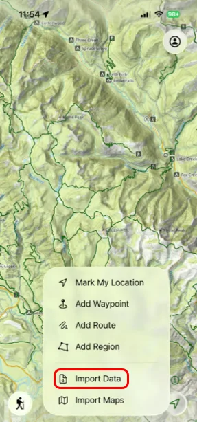
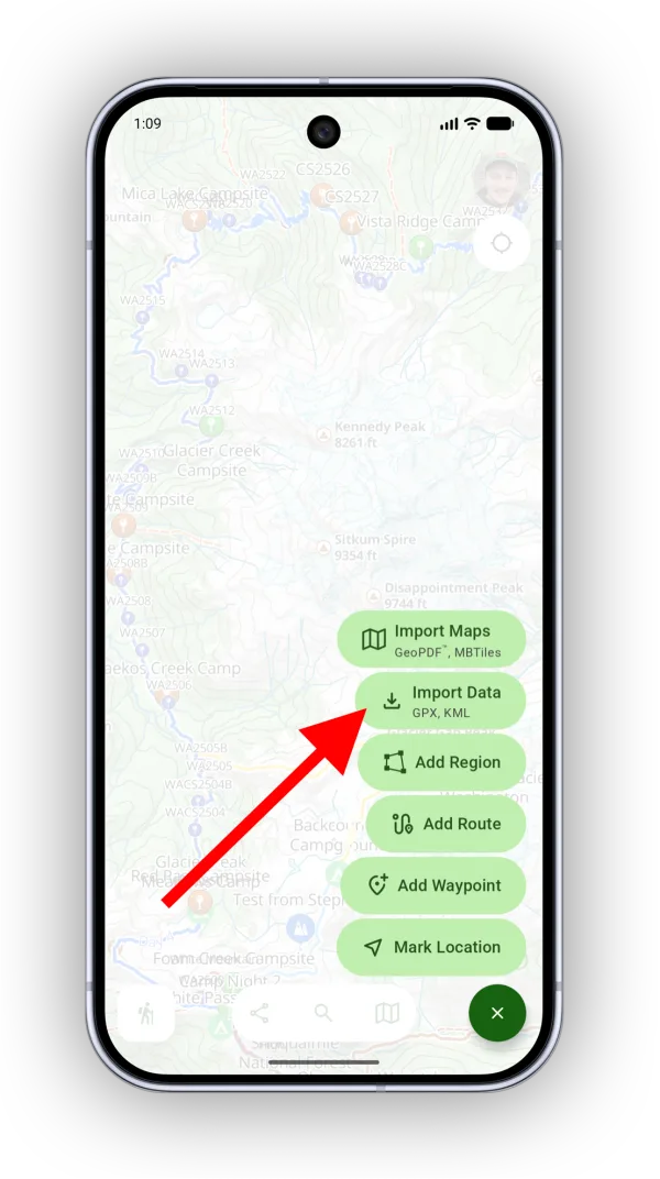
-
Select your file. Topo Maps+ analyzes it and shows the attribute schema it found.
-
Name the data layer and tap Import CSV.
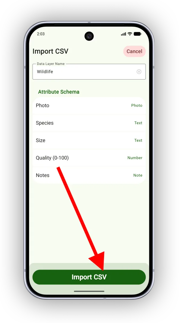
Shown on Android — iPhone looks slightly different.
To view or edit the new data layer, tap the Maps button in the toolbar and scroll down to Data Layers.
How to export a data layer as CSV
-
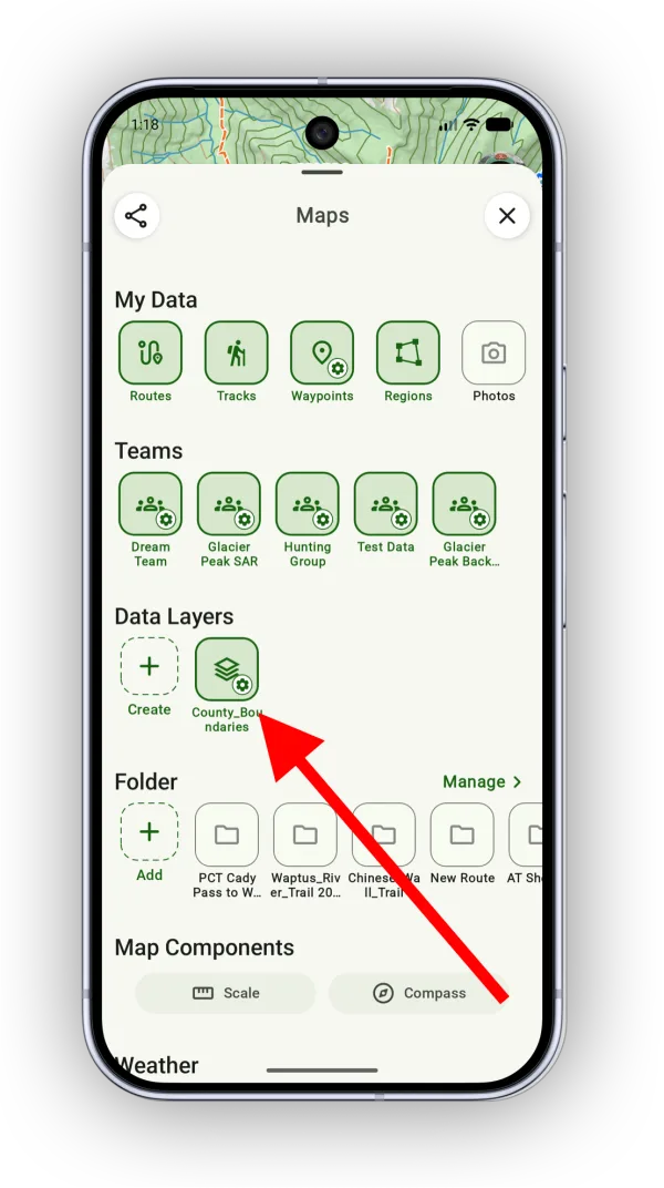
Tap the Maps button and, under Data Layers, tap the settings icon on the layer (or tap and hold it) to open it.
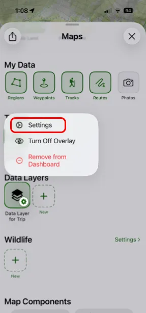
-
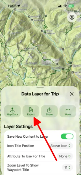
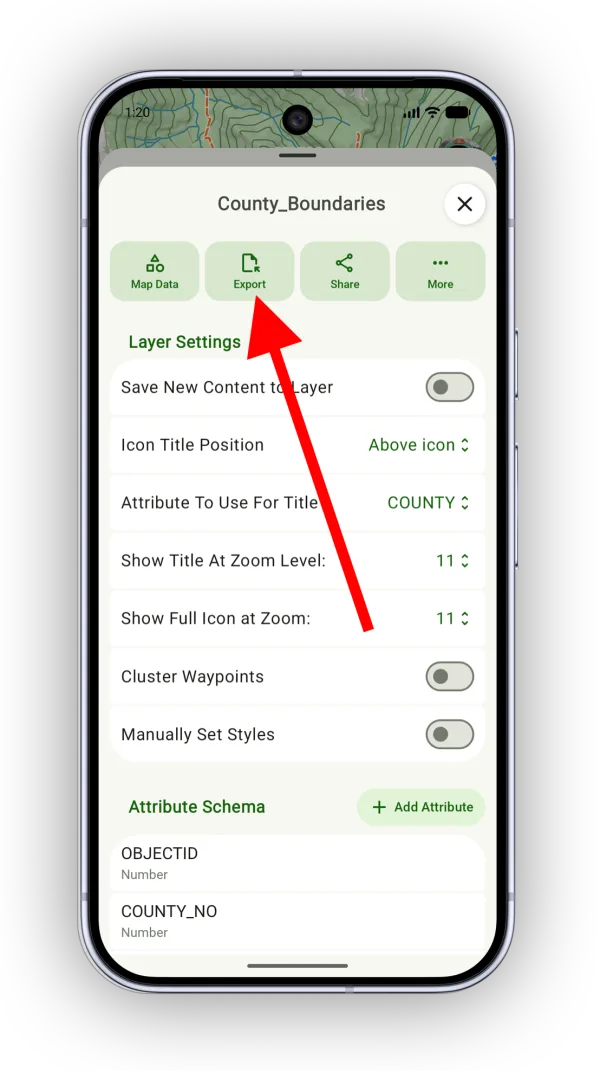
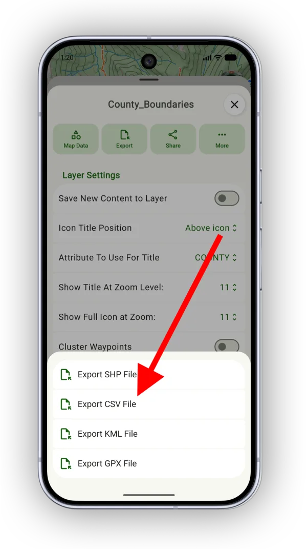
Tap Export.
-
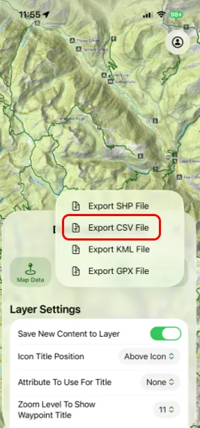
Tap Export CSV File.
Updated October 7, 2026
More in Teams & Pro Tools
Still need help?
We’re a small team and we read every message. Email support@topomaps.co and tell us which device you’re on.