
Advanced Settings
Topo Maps+ has a lot of settings you can use to tailor the app to how you use it. Most of them live on the in-app Settings screen.
How to open Settings
-
Tap your account button in the top-right corner.
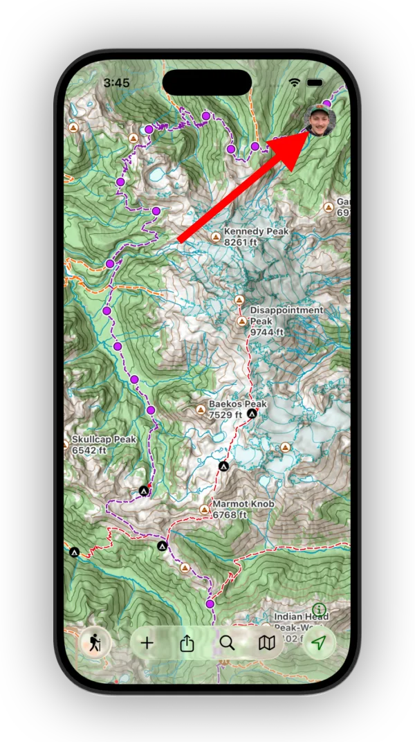
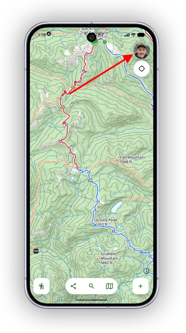
-
Scroll down and tap Settings.
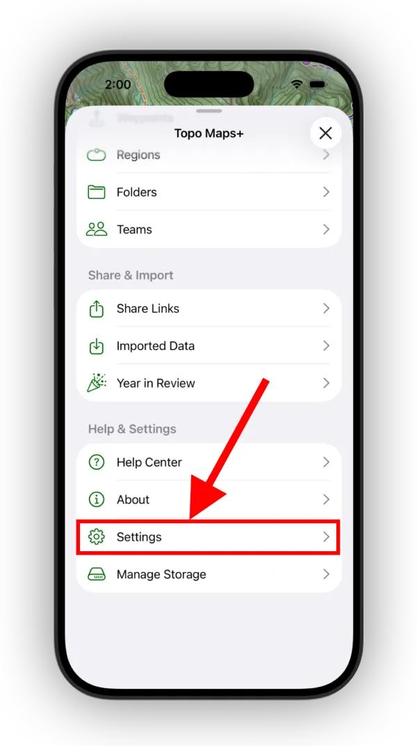
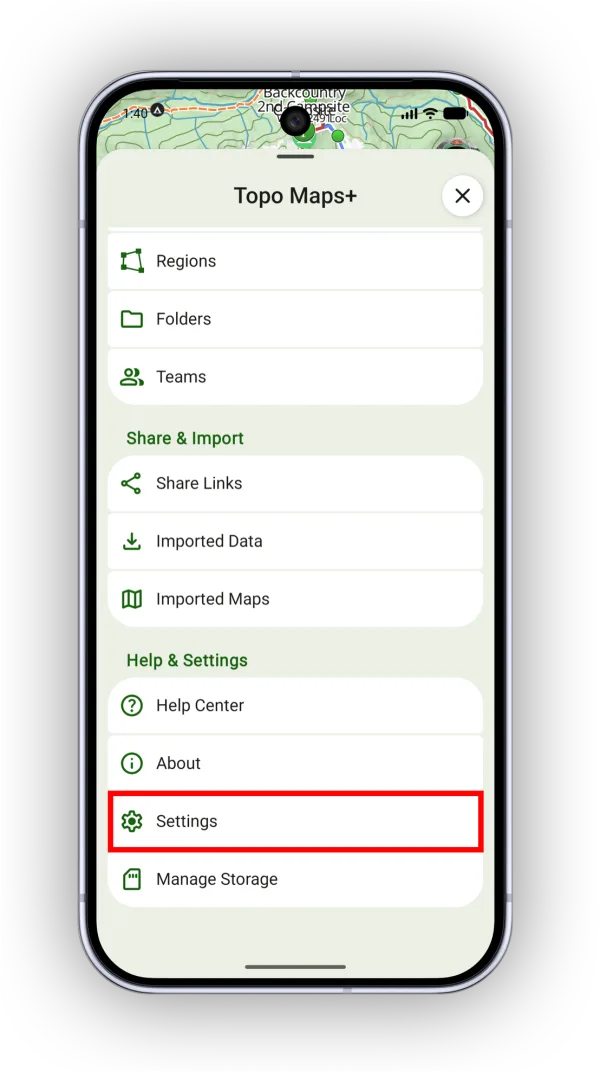
Cloud Sync
- Automatic Sync — When on (the default), Topo Maps+ syncs automatically at times like app startup and after you create data, keeping your account up to date for backup and syncing across devices. If it’s off, tap the sync button yourself to back up your data to the cloud.
- Automatic Sync Over WIFI Only — Waits for a Wi-Fi connection before syncing, to save cellular data.
General and units
- Units — Choose the distance units Topo Maps+ displays. Use Metric Units — Show distances and elevations in metric units.
- Use Magnetic North — Takes magnetic declination into account for bearings, using magnetic north instead of true north.
- Disable Auto Lock — Keeps your screen from going dark while you’re using Topo Maps+.
- Manage Storage — Frees up space Topo Maps+ is using, such as map downloads.
- Show Location Stats in Toolbar — Shows location stats at the bottom of the map.
Map
- Show Trace Magnification — Shows a magnifier when you trace a route or position the crosshairs, so you can see where you’re drawing.
- Disable Map Rotation Gesture — Locks the map pointing north, so a two-finger rotation does nothing.
- Dark Mode Dims Map — Dims the map colors when your device is in Dark Mode.
- Location Marker — Customize the size, color, and icon of your location marker.
Recording Tracks
- Auto Pause Track Recording — Detects when you stop moving and pauses the recording, so you can stop to enjoy a view without skewing your track stats.
- Disable Car Ride Detection — Turns off the notification you get when you start driving away from the trailhead while you’re still recording.
- Live Activity — Choose which stats the track recording Live Activity shows on your Lock Screen.
My Data
- Show Waypoints At All Zoom Levels — Keeps waypoints on the map even when you zoom far out. They still get very small.
- Show Waypoint Titles on Map — Shows waypoint titles next to their icons. You can set where each title appears by editing the waypoint.
- Show White Casing on Routes & Tracks — Adds a white outline to routes and tracks on the map.
Auto Add New Data To
- Save New Content to Team — Choose a team to save new data to automatically.
- Save New Content to Data Layer — Choose a data layer to save new data to automatically.
Workflows
Define rules for what happens when you create new waypoints, routes, and more. See Workflows.
Coordinates
- Coordinate Format — Choose how Topo Maps+ formats coordinates, such as latitude/longitude or UTM.
- Datum — Choose between WGS84 (the default) and NAD27.
Reset
- Reset All Route Colors & Styles — Resets every route to the default color and style.
- Reset All Track Colors & Styles — Resets every track to the default color and style.
- Delete All My Data — Permanently deletes all of your Topo Maps+ data, including what’s stored in the cloud.
Updated October 7, 2026
More in Integrations & Settings
Still need help?
We’re a small team and we read every message. Email support@topomaps.co and tell us which device you’re on.