
Map Overlays
Topo Maps+ includes a variety of maps. Some cover the globe; others cover only a specific country or area, such as the US Forest Service map. These partial-coverage maps work best as an overlay, so you still have a base map underneath where their coverage runs out.
How to add a map overlay
-
Tap the Maps button in the toolbar.
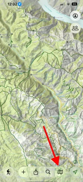
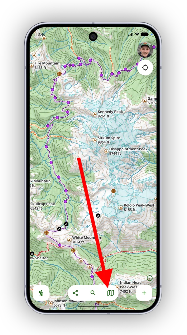
-
Scroll to the bottom of the Maps screen and tap Customize.
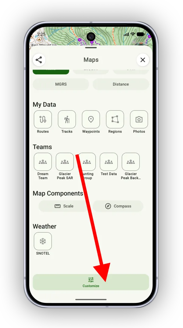
Shown on Android — iPhone looks slightly different. -
In Customize Dashboard, add the Map Overlays section.
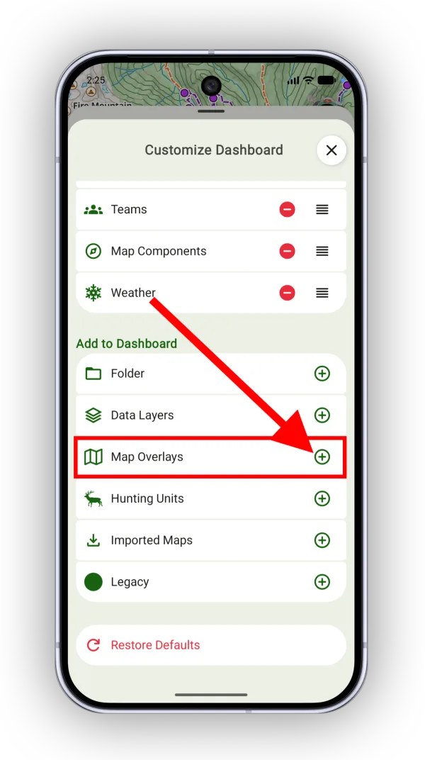
Shown on Android — iPhone looks slightly different. -
Close the customizer, find the Map Overlays section, and tap Add.
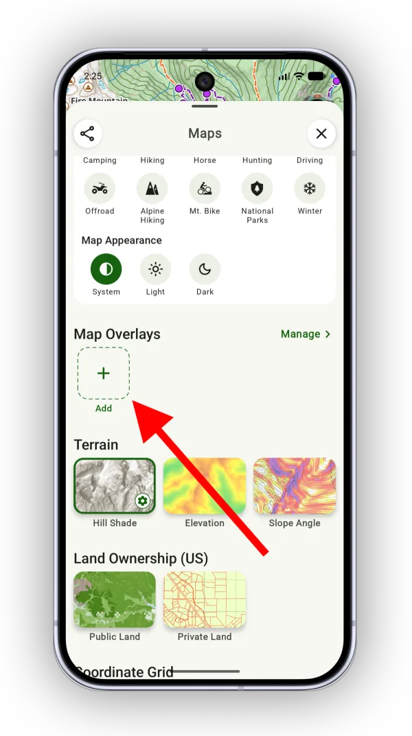
Shown on Android — iPhone looks slightly different. -
Select a map to add to the dashboard.
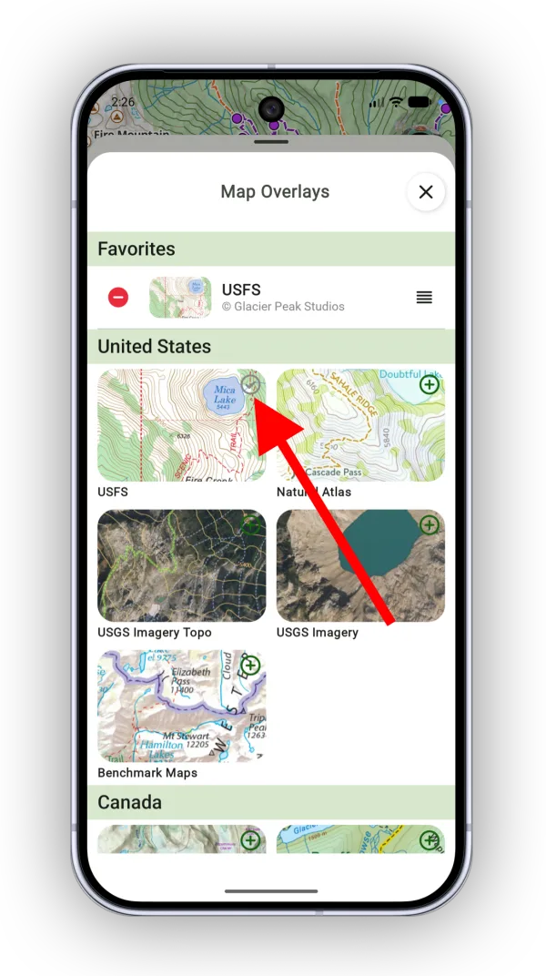
Shown on Android — iPhone looks slightly different. -
Close the map picker, then tap your map to turn it on.
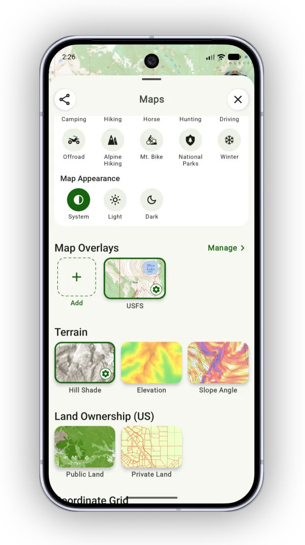
Shown on Android — iPhone looks slightly different.
Trails overlay
Some maps show trails as part of the map image itself. You can see them, but you can't select them or use them with on-trail tools. To learn what those lines mean, check the map legend.
Selectable trails come from a trail overlay (OpenStreetMap trails or US Forest Service). You can save and download them, and they work with on-trail tools, much like a pre-drawn route.
-
Tap the Maps button, scroll down to the Legacy section, and turn on Trails.
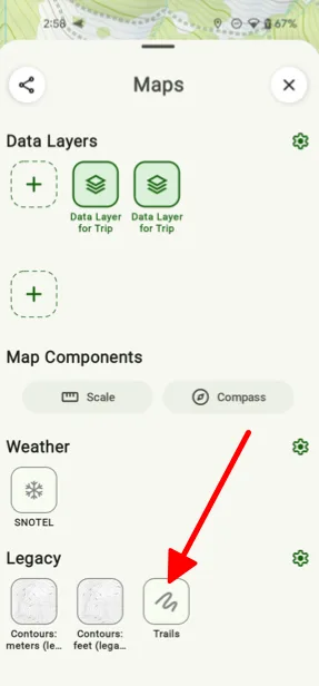
Shown on Android — iPhone looks slightly different. -
To change the trail colors, tap and hold the Trails overlay and tap Settings.
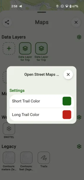
Shown on Android — iPhone looks slightly different.
Updated October 7, 2026
More in Maps & Overlays
Still need help?
We’re a small team and we read every message. Email support@topomaps.co and tell us which device you’re on.