
Elevation Heat Map on the Web App
Web app
On your phone? Elevation Heat Map
The Elevation Heat Map overlay colors the map by elevation, so you can quickly see differences in elevation or highlight the elevation ranges you're most interested in.
How to turn on the Elevation Heat Map
-
Click the Map Dashboard in the top-right corner of the screen.
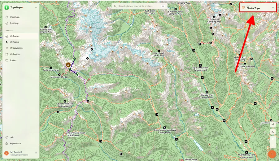
-
Scroll down to Terrain and click Elevation Heat Map.
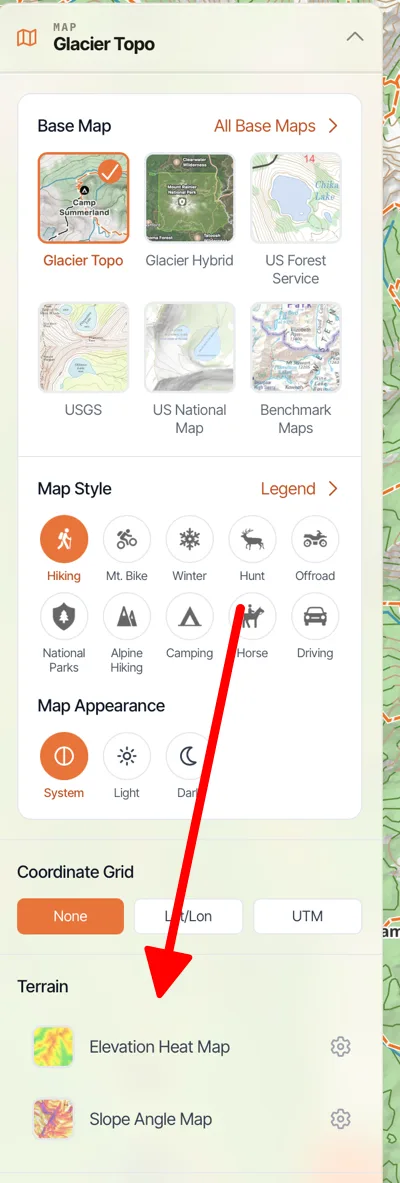
How to customize the colors
-
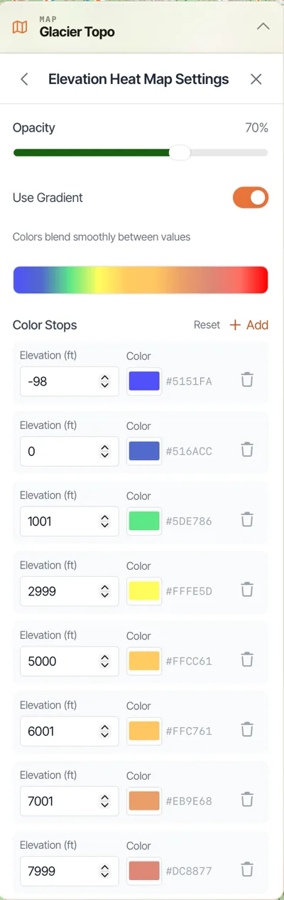
Click the settings icon next to Elevation Heat Map.
-
Set the colors you want for specific elevations.
Updated October 7, 2026
More in Web App
Still need help?
We’re a small team and we read every message. Email support@topomaps.co and tell us which device you’re on.