
Grid Overlays on the Web App
On your phone? Grid Overlays
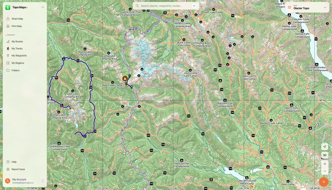
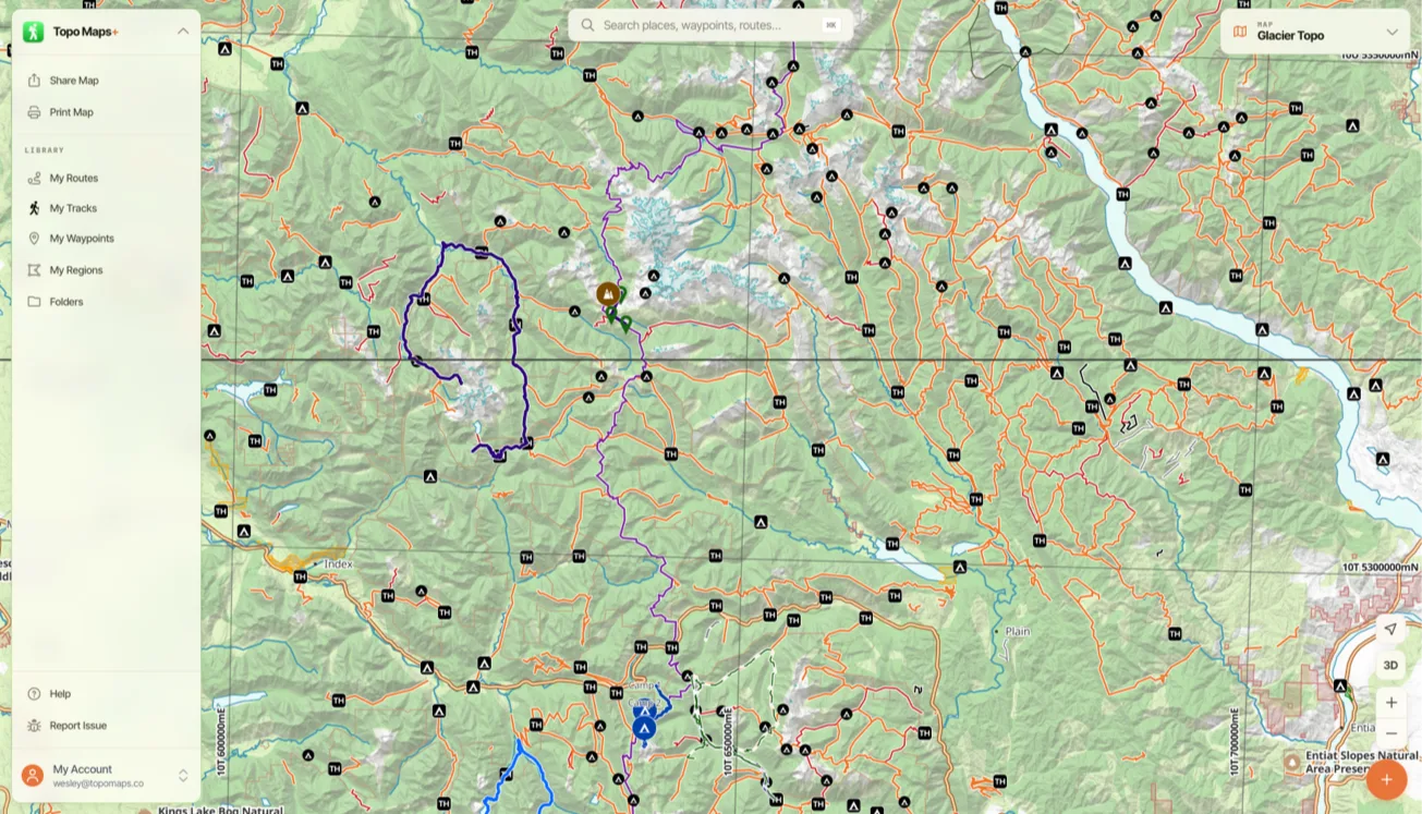
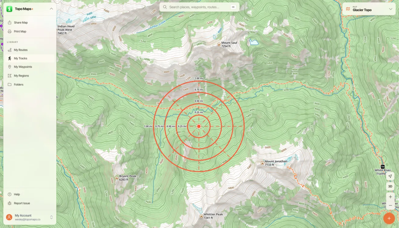
Grid overlays help you read positions and distances off the map. The web app has three kinds:
-
Latitude/Longitude
-
UTM (Universal Transverse Mercator)
-
Distance Rings
How to turn on a coordinate grid
-
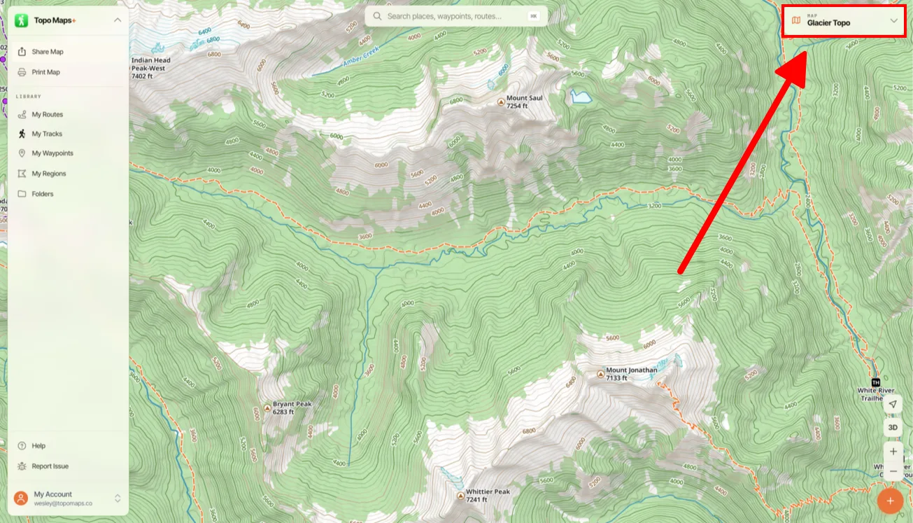
Click the Map Dashboard in the top-right corner of the screen.
-
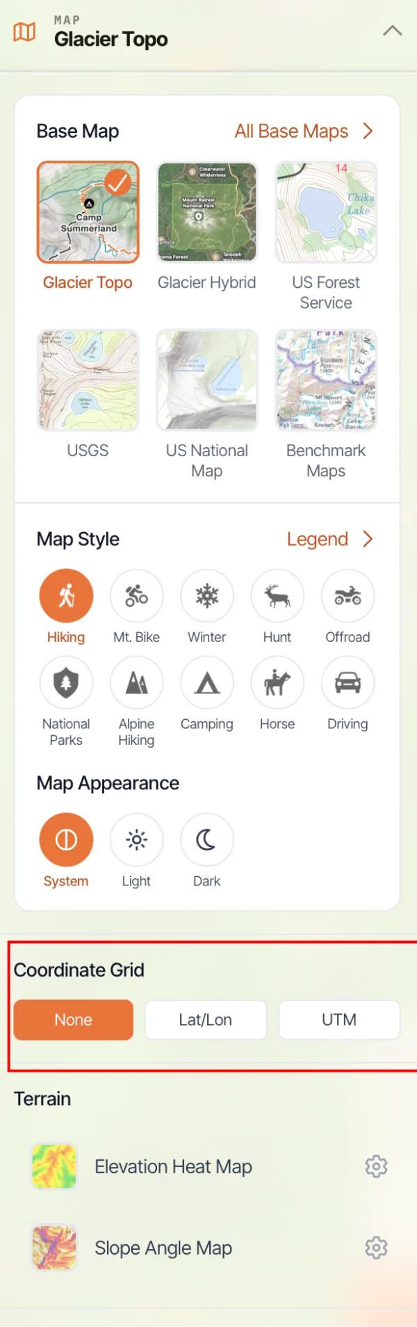
Scroll down to Coordinate Grid and select a grid, such as Lat/Lon or UTM. The list also includes Distance and MGRS grids.
How to add distance rings
-
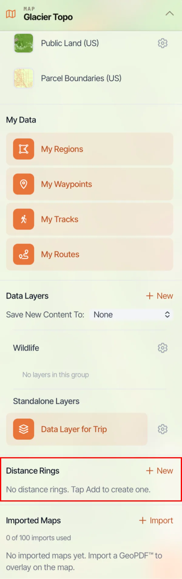
In the map dashboard, scroll down to Distance Rings and click New.
-
Drag the crosshairs to set the center of the rings, then click Place Here.
-
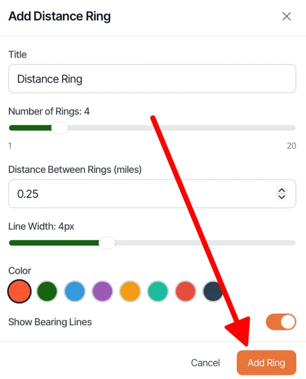
Set the title, number of rings, distance between rings, line width, and color, and choose whether to show bearing lines. Click Add Ring.
Updated October 7, 2026
More in Web App
Still need help?
We’re a small team and we read every message. Email support@topomaps.co and tell us which device you’re on.