
Land Ownership Overlays on the Web App
Web app
On your phone? Public Land Overlay (US) · On your phone? Private Land Overlay (US)
Land ownership overlays show public land boundaries and private parcels on any basemap, whether you prefer topo maps, satellite maps, or a combination of the two. They're available in the US.
How to turn on land ownership overlays
-
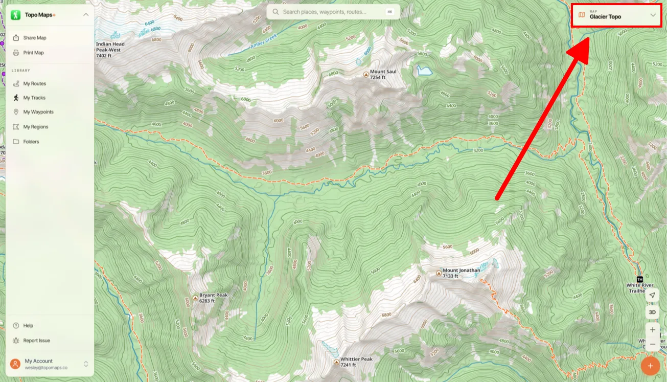
Click the Map Dashboard in the top-right corner of the screen.
-
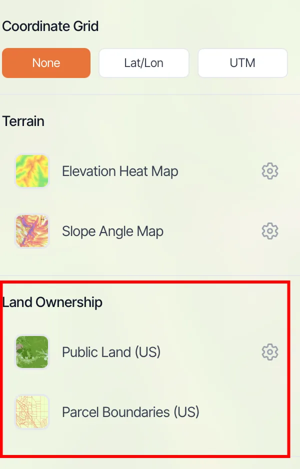
Under Land Ownership, click Public Land (US) or Parcel Boundaries (US).
-
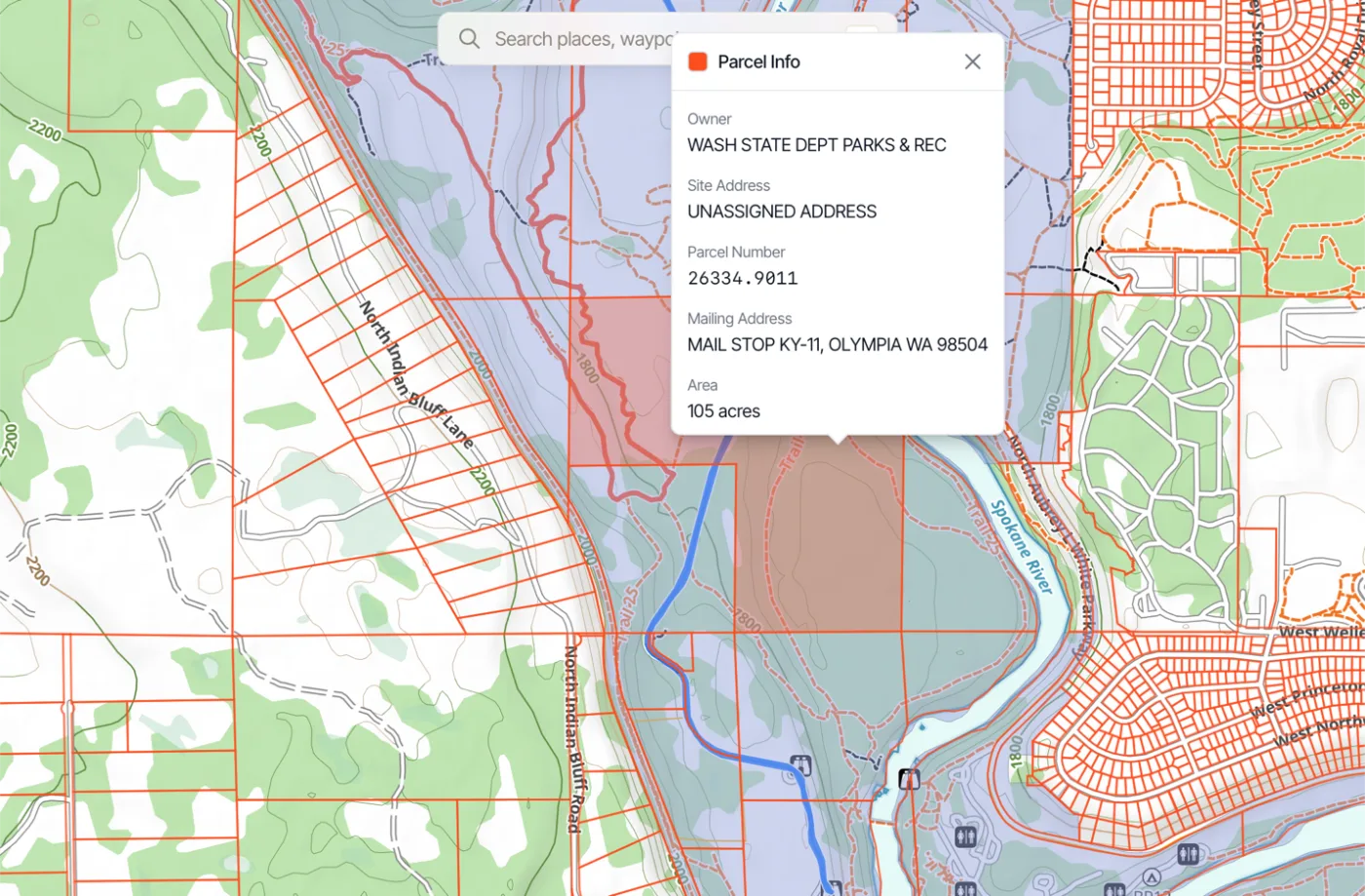
With Parcel Boundaries (US) on, click a parcel to see information about it, such as the owner, address, parcel number, and area.
Updated October 7, 2026
More in Web App
Still need help?
We’re a small team and we read every message. Email support@topomaps.co and tell us which device you’re on.