
Hybrid Maps on the Web App
Web app
On your phone? Hybrid Maps
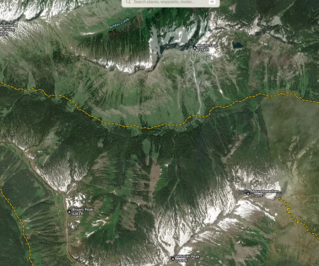
A hybrid map is a satellite map with outdoor mapping features added on top. It's helpful when you want the texture and colors of satellite imagery but still want trails and other features clearly visible.
How to set up a hybrid map
-
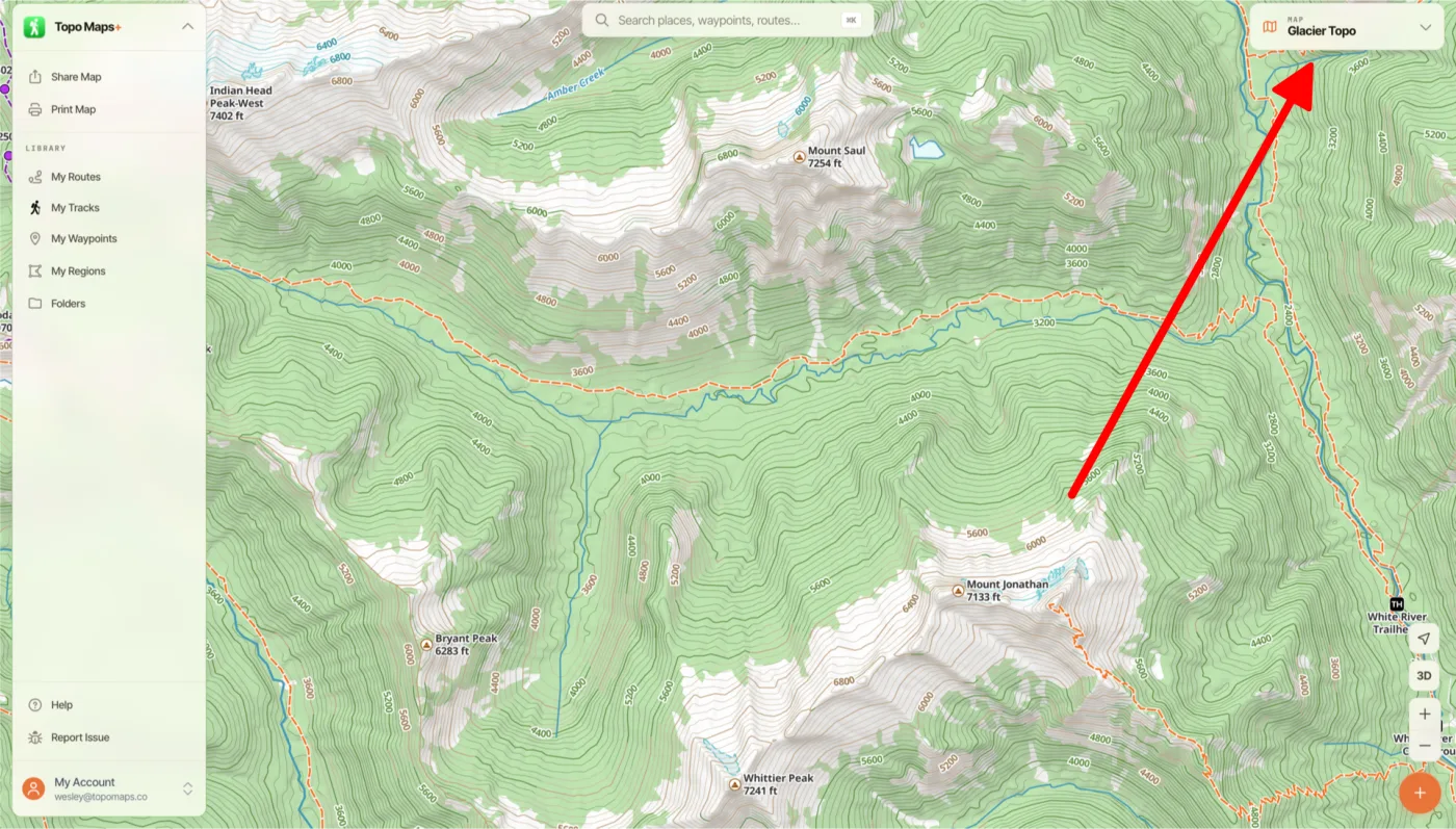
Click the Map Dashboard in the top-right corner of the screen.
-
Under Base Map, select Glacier Hybrid.
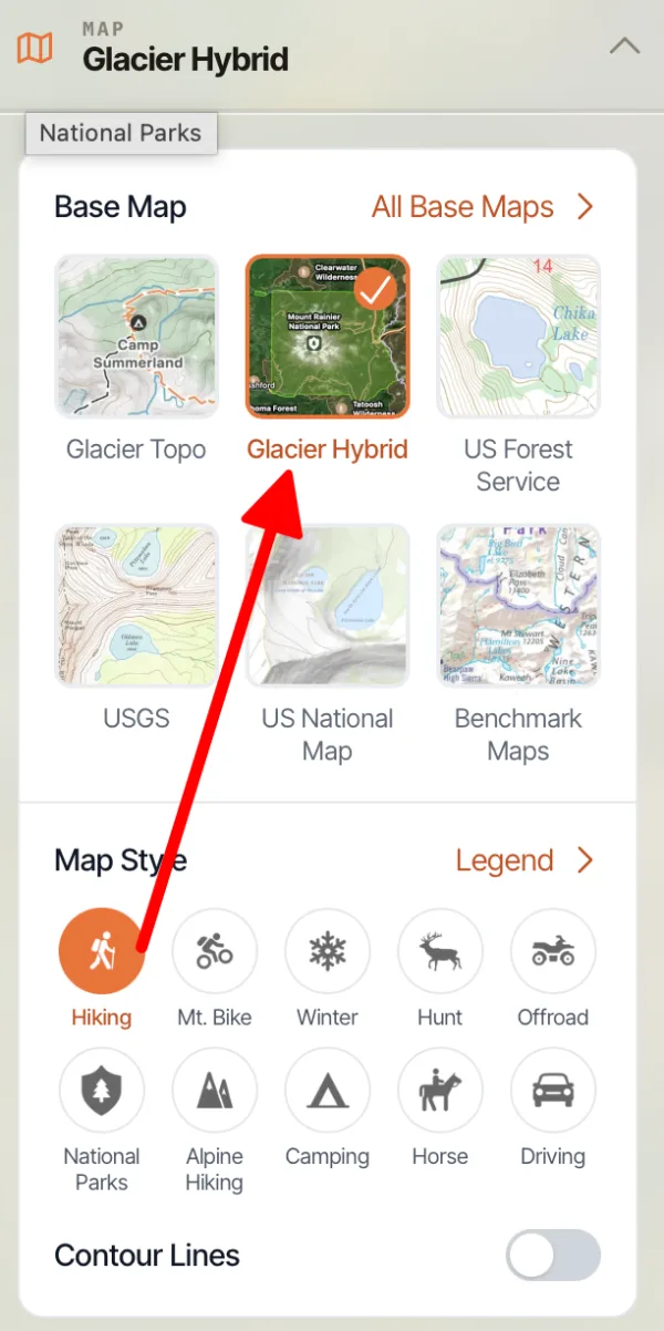
Glacier Hybrid is a satellite map with roads and outdoor mapping features on it, so it stays easy to read.
-
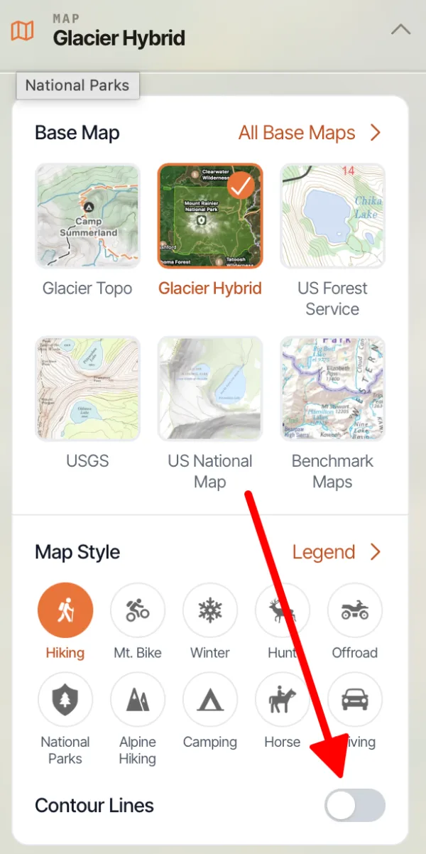
To add contour lines, turn on Contour Lines under Map Style. They're off by default.
Updated October 7, 2026
More in Web App
Still need help?
We’re a small team and we read every message. Email support@topomaps.co and tell us which device you’re on.